
DATA YOU CAN BUILD ON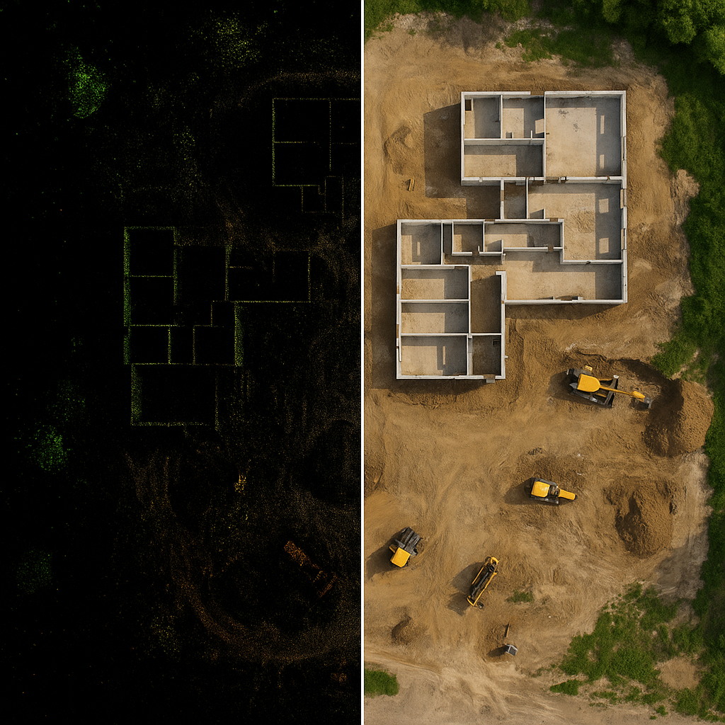

-
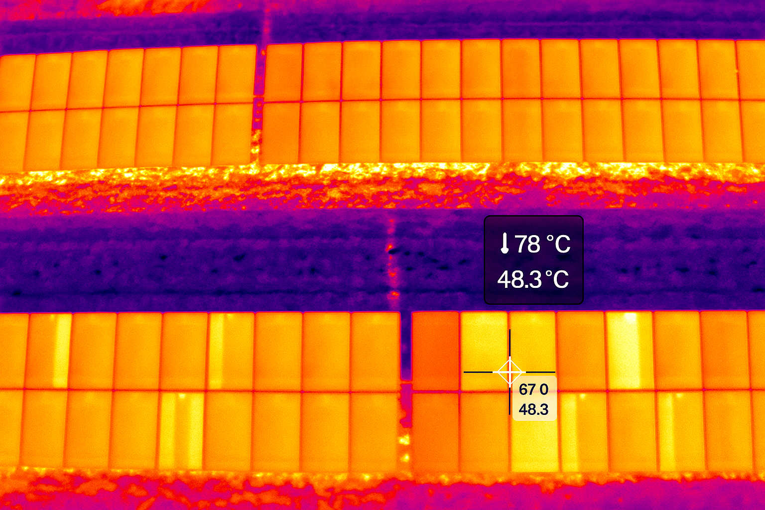
Using a drone with a thermal sensor lets you spot problem panels or components early, without shutting anything down, making the entire inspection process faster, safer, and far more cost-effective than traditional methods.
-
3D models (identical twins ) give teams a precise, full-site view without sending people into risky or time-consuming areas, streamlining planning and inspections while keeping costs down.
The drone captures enough angles and detail for the software to rebuild a true-to-life 3D model—a digital twin—that matches the physical asset in shape, scale, and measurable accuracy. -
High-resolution aerial maps give teams a reliable, measurable view of an entire site in minutes, improving documentation, planning, and decision-making at a fraction of the cost of traditional surveys.
-
AeroDatum Technologies provides consulting and program development services for law enforcement, fire departments, and emergency management agencies looking to implement or expand drone operations.
Services include drone program setup, policy development, equipment selection, training guidance, and operational planning for both trunk-deployed systems and Drone as First Responder (DFR) deployments.
Our approach focuses on building programs that are operationally effective, legally compliant, and sustainable for agencies of all sizes.